Correct Option
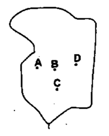
The map depicts key locations within the erstwhile state of Jammu and Kashmir. Identifying the positions marked A, B, C, and D based on their geographical context leads to the following:
- Point A represents Baramula, situated in the northwestern part of the Kashmir Valley, along the Jhelum River.
- Point B represents Srinagar, located southeast of Baramula, serving as the summer capital of the region and centrally positioned in the Kashmir Valley.
- Point C represents Anantnag, which lies further south of Srinagar in the South Kashmir region.
- Point D represents Kargil, positioned to the northeast of Srinagar, within the Ladakh region, known for its high-altitude terrain near the Line of Control.
Therefore, the sequence Baramula, Srinagar, Anantnag, and Kargil correctly corresponds to points A, B, C, and D respectively.
Incorrect Options
The other options are incorrect because they misplace one or more of the identified towns. For instance, some options interchange the positions of Anantnag and Kargil, or incorrectly locate Baramula, which is geographically situated in the northwestern part of the Kashmir Valley, not in the south or east as implied by other sequences.